While operating a logistics or transport business, the owners have to ensure the safety of the vehicle as well as of the people inside the vehicle while in transit.
The vehicles need to move at a certain speed on a certain type of road.
The speed limit is set by the government based on the kind of roads and the quality of construction
There are different types of roads based on the location and quality of build, each with a purpose to support a certain kind of traffic. These could be city roads, state highways, national highways, flyover roads, and express roads.
All these kinds of roads have speed limits defined by the road constructing authority to ensure the safety of the vehicle and the people in them. One would notice these speed limit signboards put up on the side of the road.
Drivers are expected to keep adjusting the speed limit as soon as they see the sign.
Few factors considered while deciding the speed limit
- the kind of vehicles is authorized to go on that road. Not every road is constructed to allow all kinds of vehicles. As there are different types of vehicles categorized by the length or width of the vehicles, similarly there are different kinds of roads categorized by the width, angle of the curve, construction material, etc.
- the material used to construct the road. The material used is decided considering the purpose of the road.
- establishments near to the road. For example, roads near schools, residential areas, or villages will have lower speed limits compared to expressways or highways.
- angle and turns on the road also are factors used while deciding the speed limit. The sharp angular road will have a lower speed limit.
If drivers drive beyond the defined speed limit,
- they would have to pay a hefty fine when caught by the authorities
- would risk the lives of people on board. Be it travel vehicle or goods transport vehicle; the risk is always present.
- cause extensive damage to the vehicles which would, in turn, be a financial loss for the company.
- hurt the company’s image. This would in turn hamper the business. Thus, companies ensure that the drivers comply with the speed limit.
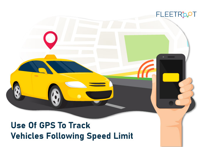
To ensure that vehicles adhere to the speed limit the fleet master who monitors the movement of the vehicles uses GPS.
The GPS is a tracking system and uses either a cellular network or satellite tracking to locate something.
The data from GPS is being used in many ways to perform many tasks, however, in this blog, we will understand how it helps track the speed of vehicles to ensure that it complies with speed limit and other safety regulations.
1.The GPS is embedded in the software used by the travel and transport companies to track the movement of the vehicles.
The software has many sub-parts to it and communicates with each other to provide the required data.
It could be either location, speed at which the vehicle traveled, etc. Some countries have made it mandatory to record and store travel data logs.
2.The GPS works in either real-time data update of the vehicle or stores the data in the GPS devices which are fixed in the vehicles and are later downloaded to the system.
Apart from this, the drivers are required to install an application on their phones to get details of the trip. This application could have GPS functionality and do the required calculations and transmit the data to the fleet master’s console in real-time.
3.Speed calculation and notification can be either done in real-time or the average travel time can be considered for which the calculation can be done using multiple trips.
To get a better reading, the software is set to calculate the average reading of a long journey. As more the vehicle travels and the more time and speed measurements are taken, the better the results of average speed reading.
4.The GPS also serves as a monitoring system and alerts the fleet master only when the speed limit of the road is crossed.
The roads are shown in the GPS device also have speed markings that are visible on the screen.
This data is fed in the system and is maintained for the drivers to refer from time to time and adjust their speed.
5.Using the above real-time alert system, the fleet managers are notified when the driver breaches the speed limit.
The drivers are communicated instantaneously and are advised to control the speed if they would have failed to notice the speed signboard by any chance.
6.The GPS data along with the records of driving beyond the speed limit can help the companies take disciplinary actions in time to ensure safety thus preventing any kind of loss, be it financial or loss of life.
The data could either indicate drivers being tired due to overburden of work and help companies frame rules to ensure drivers get proper rest or could also tell the companies about the drivers violating the speed limit on purpose and could discipline them.
Statistically, the number of fatalities in road mishaps is primarily due to neglecting the speed limit.
While going through the blog, we have understood the necessity of driving within the speed limit.
While some argue the data from GPS would not be accurate, modern vehicles also use data from the chip onboard the vehicles.
This is fixed by the manufacturers and collects various performance data like speed, mileage, etc. this is then used by the fleet manager to compare with GPS data and obtain the required results.
The speed limit fixed by the respective authorities is to ensure the safety of people.
The companies who operate buses and other transport vehicles use GPS extensively to follow the set speed limit for rules compliance and safety.
Would you like a demo to see how GPS Tracking Software functions?

